It was only in 2002 that scientists speculated that the 'certaine wonderfull ouerflowings of Waters' that hit coastal villages from Cornwall and Pembrokeshire up to Monmouth on 30th January 1607 might have been a tsunami funnelling up the Bristol Channel, and the exact nature of the inundation seems to be in dispute still. I've been fascinated by the story for a long while now. I visited Puxton Church in Somerset nine years ago, where there's a mark on the wall indicating the height to which the waters reached, but for the purposes of this blog, yesterday's jaunt over the bridge for a spot of church-hopping on the Gwent Levels might well constitute the first in a series of posts describing visits along both sides of the coastline.
A contemporary account by Willliam Jones of Usk describes the waves as 'huge and mighty Hilles of water, tumbling one over another, in such sort as if the greatest mountaines in the world'.
Maps of the extent of the flooding show that much of the land on both sides of the estuary was affected, with reports of devastation and lives lost from every county. We know that waters penetrated the Somerset Levels as far as Glastonbury. Not many villages or Churches record the event, however.
St Mary the Virgin in Nash on the Gwent Levels does, so I headed there first. I'd never been to this corner of Wales before, and was startled by how familiar it felt, with its long, straight causeways, higher than the surrounding fields and bounded by ditches that are called reens in Wales and rhynes in England - the pronunciation the same, though. And I had the same dreamy feeling I get when driving through the Somerset Levels, where one strand of my family comes from.
It was noisy in the churchyard, due to the presence of a sizeable rookery and a fair few jackdaws too.
I tried the church door and it was locked, so I wandered around the grounds.
This St Mary's is believed to be the Church in the illustration of the Flood above. Certainly the tower and spire look similar.
There is a mark on the tower showing the height of the flood waters. It came up to my mouth, so about five foot.
I was a bit fed up that I couldn't get in, though. Then I remembered someone had followed me and the dog up the church path. I went and tried the door again. It was open ...
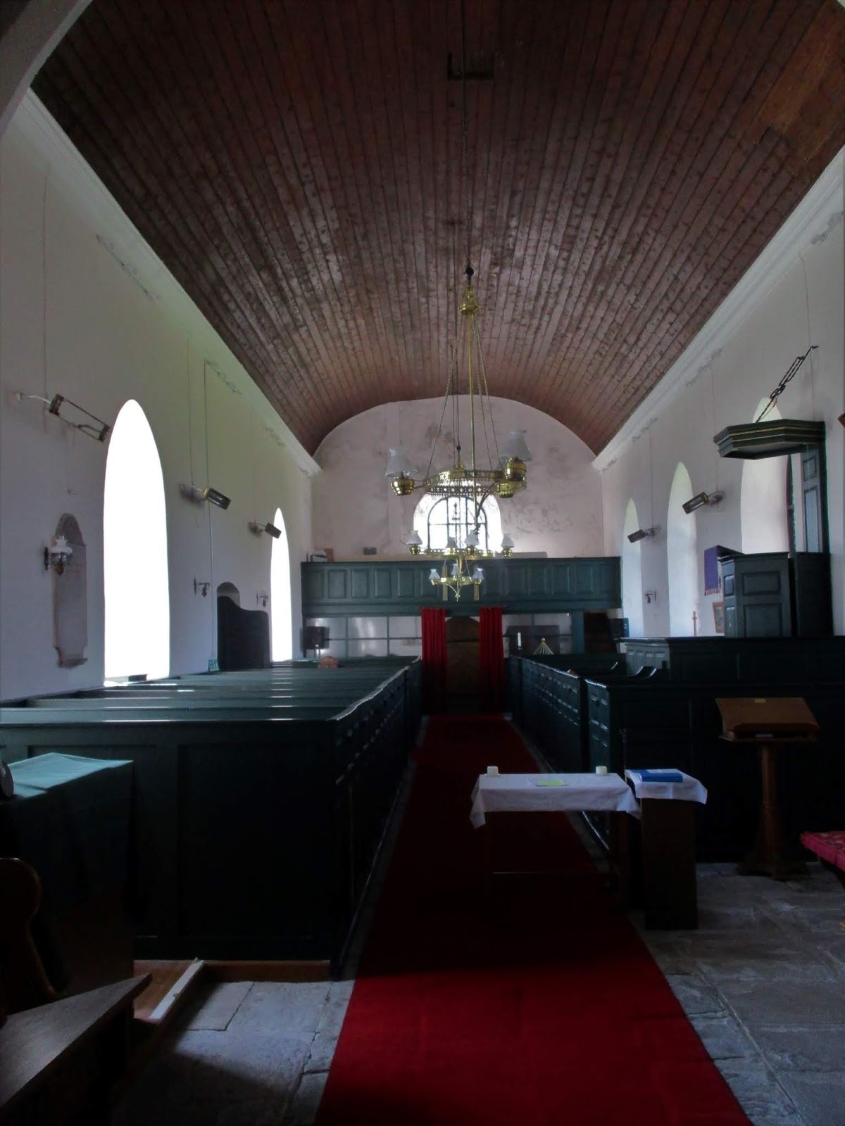
... and I discovered that the Church still retains many of its Georgian fittings - box pews, gallery, pulpit. Very impressive.
I liked the modern stained glass in east window very much, but I haven't been able to find out who made it, or indeed much about the interior of the church at all.
There was a reproduction of an account of the flood on the nave wall. (The date 20th January is explained by the vagaries of Julian v Gregorian calendar, and 1606 by the fact that at this time, new year was at the end of March.)
TO ALL AND
SINGULAR AND TO ALL THESE PRESENTS SHALL COME OR WHOME THE SAME IN ANY WAY
CONCERN THAT THIS WOFULL PROCLAMATION FROM WALES
'INASMUCH as this
lamentable newes out of Monmouthshire in Wales contayning the wonderfull and
most fearfull accidents of the great ouerflowing of waters in the said countye
drowning infinite number of CATTELL of all kined as SHEEPE, OXEN, KINE and
HORSES with others: the losse of many men women and children and the wofull
subversion of over XX PARISHES in Januarie last, WHEREBY a great number of his
MAJESTES subjects inhabiting in those partes are utterly undone WHEREAS many
parises were spoyled by the greeuous lamentable furie of this FLOD which hapened
in the YERE of our LORDE and in the REIGN of our GRACIOUS SOVEREIGN MAJESTE Kyng
JAMES on the morne of the XX Januarie 1606'
It took the dog and me a while to find St Mary Magdalene at Goldcliff, mainly because it's tucked away behind the village pub and a lot of vegetation.
Oh, but it was so very enticing. Look at that buttress!
It was also locked, which was a shame as there is a brass plaque dating from 1609 which commemorates the flood inside.
Argh.
There was some writing on the outside wall too, but nothing I could make out, not speaking plant.
We wandered about a bit and took in what looked like the stump of an old cross.
Then we drove on to the sea walls, to see what protection from the estuary the current village has. My first swallow of 2019 swooped past, and a stoat scampered across the causeway, well ahead of my car.
Many of the villages affected by the Flood of 1607 were vulnerable because the monks had been responsible for the flood prevention prior to the Dissolution of the Monasteries and no upkeep had been carried out since.
And even before then, in 1424, Goldcliff Priory had been lost to the sea during a storm.
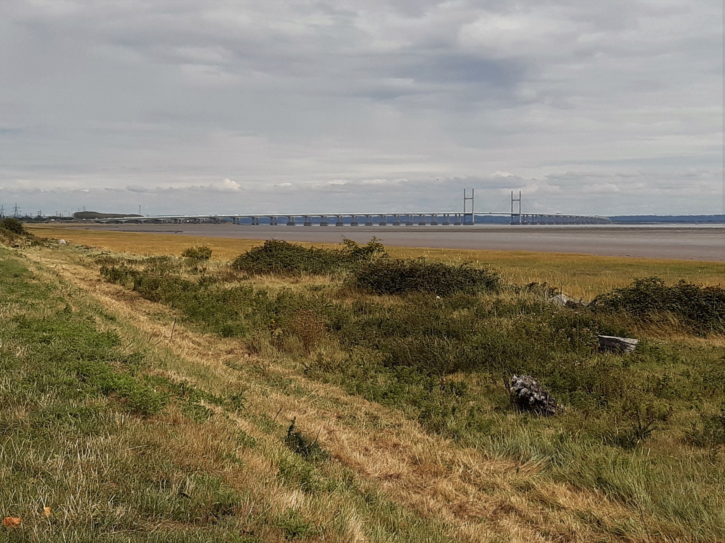
Looking across to Avonmouth ...
... Portishead ...
... and Clevedon.
Ted and I had a wander along the top of the sea defences, river on one side, reen on the other.
Again, the landscape looked very familiar.
Eventually both Severn bridges came into view and we turned back, to the sound of the wobbly water call of a curlew.
It was getting on a bit and I was minded to get back to Bristol before the rush hour, but somehow found myself putting the postcode for the Church of St Thomas at Redwick into the sat nav.
 But before that, a bus shelter doubling as a museum and filled with all sorts of interesting bits and pieces ...
... including a cider press. (Apparently, lots of cider was made in Redwick.)
I like that the esoteric vocabulary of the Severn flood plain is the same here as on the other bank. The river and its stringencies uniting rather than dividing. Though I'd be interested to know what the Welsh language equivalents are.
The village stocks
There's a flood mark on the exterior of the church, by the porch.
I think it's the mark above the words GREAT FLOOD that's the relevant one. (It's complicated by being inscribed on top of a scratch sundial.)
Another reminder in an empty niche.
Inside ... ooh, look, a rather unusual baptistry, which fills all by itself after heavy rain, the Church being just below sea level.
And a still extant rood loft (although the screen was lost during the war, when a bomb fell in the neighbouring field).
And a 13th century font.
There were a few mediaeval stone heads about the church.
This very beautiful one is a modern replica of one that was stolen, but has since been recovered (and now kept elsewhere).
It really was time to be getting back now, though, through the evening rush hour, to home and the bats' return to our back garden.